
Croaghaun [An Cruachan]
Good walks are even better shared.
Overview
Croaghaun [An Cruachan]
Overview
Croaghaun, or An Cruachan, is a splendid peak located in Connemara, County Galway, excluding your typical tourist trails, it invites hikers seeking rugged beauty and breathtaking views. Standing at a respectable 665 meters, it's not the tallest mountain in Ireland but it gives quite the run for its money in terms of views!
Geology
Characterized by rugged limestone cliffs created during the Carboniferous period, this mountain is not just another pretty face. With its close-knit association with the unique karst topography found in the region, Croaghaun unfurls a geological story that is intriguing at every turn.
Routes
From Derryinver
This challenging route is a favourite among seasoned hikers. Starting at Derryinver bridge, the journey meanders through glacial valleys before making a steep ascent to the summit. This approximately 10 km hike takes about 4 hours and is rewarded with stunning vistas.
Summit Features
At the summit, you can find a substantial stone cairn, perfect for that triumphant selfie moment, alongside a trig point that adds a twist of human achievement against nature's backdrop.
Terrain
Expect rugged and rocky pathways interspersed with sections of luscious grass. And remember, a little bog is all part of the experience - embrace the splashes!
Views
Highlights
Once on top, be prepared to be blown away by panoramic views. From Clew Bay to the far-off peaks of Achill Island, it's a visual paradise!
Best Seasons
The best times to tackle Croaghaun are during spring and autumn, when nature bursts into colour and the weather is generally more forgiving than those drizzling Irish winters.
Hazards
While not for the faint of heart, the steep ascents can be tricky with loose rocks underfoot. Always be prepared for rapidly changing weather; if the clouds come rolling in, it's wise to head down sooner rather than later.
Nearby Summits
Croaghaun is flanked by some notable peaks, including Mweelrea and Ben Bulben, which can easily be added to your hiking itinerary!
Access
Nearest Parking
Parking is available at the Derryinver bridge, but be sure to park respectfully as it's near working farmland.
Public Transport
Public transport options are limited, but you can catch a bus to Clifden and prepare for a short trek to the beginning of your adventure.
Nearest Town
The charming town of Clifden lies about 11 km away, providing all the amenities a hiker could wish for!
Facilities
For post-hike replenishment, head back to Clifden where cafes serve up some of the best coffee and treats in the region, alongside public restrooms that one always appreciates after a day in the great outdoors.
History
Name Meaning
The mountain's name, An Cruachan, means 'The Rounds', hinting at its rounded shape that has stood for centuries, entwined with Irish folklore.
Significance
Croaghaun is not just a hill; it’s part of the rich tapestry of Irish history, featured in many local legends and stories.
Conclusion
So, dust off those hiking boots and embrace the rugged allure of Croaghaun! You'll be rewarded with tales to tell and memories to cherish. Just remember to pack a raincoat - it wouldn't be Connemara without a bit of liquid sunshine!
Explore routes near Croaghaun [An Cruachan]
Public walks starting within 80 km of this hill. Nearby does not mean a route reaches the summit; check its map and access before setting out.
No public routes are currently listed within 80 km of Croaghaun [An Cruachan] on Walkmates. This does not mean there are no paths here. Explore the map and check local access information before planning a walk.
Route planning notes
These notes describe possible approaches, not verified navigable routes or permission to cross land. Check current paths, local access rules and conditions before setting out.
From Derryinver
A scenic hike starting from the Derryinver bridge taking you along the glacial valleys before ascending towards the summit, offering stunning coastal views.
Make a day of it, together
Find someone to share the walk with, or organise a day out along a route you like.
Hill facts and local notes
Classifications
Elevation
456m
1,494 ft
Prominence
117m
Coordinates
52.6636, -6.7677
S834576
OS Map
68
At the Summit
The summit is marked by a large stone cairn, which bears witness to many a weary hiker's journey. There is also a small trig point that adds a bit of character to the ridge.
Terrain & Geology
Croaghaun is predominantly composed of steep limestone cliffs, which were formed during the Carboniferous period, along with intriguing geological features such as karst landscapes. These cliffs are not just for show; they offer stunning views and a slice of natural history.
Views & Scenery
Panoramic views of Clew Bay and the rugged Atlantic coastline, as well as a clear sight of the Nephin Beg mountains in the distance. On a clear day, you might even spot the distant peaks of Achill Island.
History & Heritage
Name Origin
An Cruachan translates to 'The Rounds' in Irish, possibly referring to the conical shape of the mountain. It reflects the ancient connection of the Irish landscape with folklore and history.
Historical Significance
Croaghaun holds a place in local folklore and has been a point of interest for generations, often being referenced in stories about the rugged beauty of Connemara.
Getting There & Facilities
Check current local access restrictions, parking rules and transport timetables before travelling. These notes do not confirm public access to the summit.
Parking
There is parking available at the Derryinver bridge, suitable for a few cars. Please park considerately as this area is also used by local farmers and residents.
Public Transport
The nearest bus service connects via Clifden; however, be aware public transport can be sparse, so plan ahead and be ready for a bit of a stroll to the start.
Nearby Facilities
The nearest cafe is located in Clifden, which serves excellent coffee and pastries – essential post-hike sustenance! Public toilets are also available in the town.
Safety Information
Known Hazards
- Steep terrain with loose rocks requires careful footing. Weather can change rapidly, so be prepared for sudden showers or gusty winds.
General Safety Tips
- Check weather conditions before setting out
- Carry appropriate clothing and equipment
- Let someone know your planned route
- Take a map, compass, and GPS device
- Carry emergency supplies: food, water, first aid kit, torch
Hills
Some common questions about the hills answered
Are there group walks up Croaghaun [An Cruachan]?
Many walkers use Walkmates to join or organise walks with others. You can check for group walks around Croaghaun [An Cruachan] through the maps
Are there other walkers around Croaghaun [An Cruachan]?
Activity varies by location and time, but Walkmates lets you see whether others have shared walks or shown interest in this area. Find other people through the walking friends search walking friends for Croaghaun [An Cruachan] search or of course create your own walk for Croaghaun [An Cruachan]
Can I organise a walk to Croaghaun [An Cruachan]?
Yes. If there aren’t any walks listed already, you can create a walk and make it available for others to join.
If you're signed up to Walkmates, you can create a walk to Croaghaun [An Cruachan].
How do I find a walk up this hill?
There are often multiple ways to walk this hill, depending on experience and route preference. Walkmates helps you explore walks and routes that others have shared.
Can I suggest a new route up Croaghaun [An Cruachan]?
Yes. You can suggest or create routes to share with others. Walkmates focuses on the social side of walking, so routes are used to help people organise walks and explore areas together, rather than as detailed navigation tools or route libraries.
Other uses really appreciate knowledgeable walkers sharing their routes. Share your favourite route to Croaghaun [An Cruachan] here
The is an error or something incorrect about this hill. How do I let you know?
We always strive to keep the information on Walkmates as accurate as possible. If you find an error, please let us know through the contact form and we'll aim to correct it as quickly as possible
Community Discussion
Comments
Location
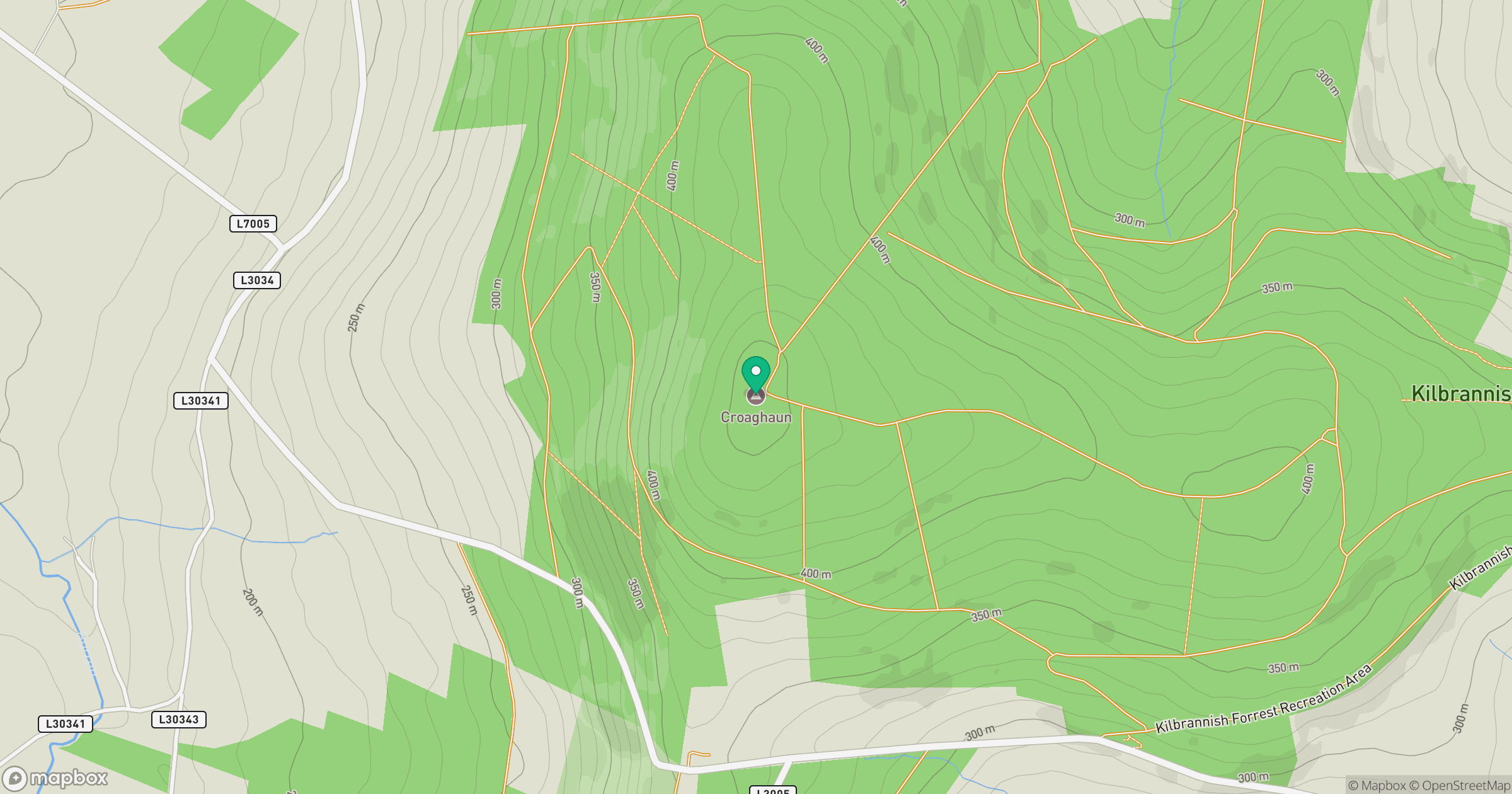
Grid reference: S834576
View on OpenStreetMapOpens a map in a new tab, centred on the hill.
Hills within 30 km
Straight-line distance, not a walking route or confirmation of access.
No comments yet. Be the first.